I love the idea of stitching together a multi-day trek that threads coastal footpaths, lonely bothies and a warm cuppa in a local café. In Durness that kind of trip feels perfectly balanced—wild sea-swept cliffs and quiet beaches by day, the comfort of a bothy or village kitchen at night, and the small joy of supporting local businesses along the way. Below I share how I plan these low-impact adventures, practical route ideas, safety notes and sensible kit choices so you can enjoy the Highlands while leaving it as pristine as you found it.
Choosing a low-impact route: principles I use
When I design a multi-day trek around Durness I try to keep three simple principles front of mind: respect fragility, limit erosion and support local services. That means favouring established paths, avoiding sensitive nesting areas (especially in spring and early summer), and balancing wild camping or bothy use with village stops where I can buy food or hot drinks.
- Stick to marked paths where possible—these concentrate footfall and reduce trampling across vulnerable vegetation.
- Seasonal awareness: time your trip to avoid seabird and deer calving seasons when routes pass nesting cliffs or crofting land.
- Use bothies responsibly: follow the bothy code—leave no trace, take rubbish away, use a stove carefully and avoid long stays when others are waiting.
- Support local cafés and shops: they reduce your need to carry heavy food and contribute to the community you’re visiting.
Planning logistics: maps, transport and timing
I always start with an Ordnance Survey map (I use OS Explorer 443 for the area) and overlay it with the OS Maps app. Mark the coastal paths, bothies (from the Mountain Bothies Association), and villages with cafés—Durness itself has a couple of great spots and nearby Balnakeil and Sangomore often have seasonal options.
Transport-wise, Durness is remote: plan your arrival and exit carefully. The A838 is the main road in; there are limited bus services (check Stagecoach timetables) and arranging a drop-off/pick-up with a local taxi or friendly B&B is useful. If you leave a car, park considerately—use signed car parks rather than blocking hard shoulders or farm accesses.
Sample 3-day low-impact itinerary I often recommend
This is a flexible outline I’ve walked, mixing popular coastal sections with quieter inland links and an evening bothy stay.
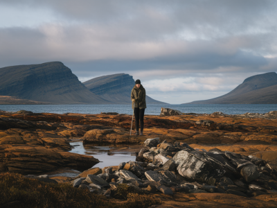
- Day 1: Balnakeil Bay to Smoo Cave to Durness (approx. 8–10 km)
Start on Balnakeil beach at low tide if you want that expansive sand and sea look. Walk past Sango Bay and make time to descend to Smoo Cave. From there follow the coast path into Durness village—stop at the shop or a café to resupply and enjoy a hot meal. - Day 2: Durness to Sangobeg Bothy via coastal cliffs (approx. 12–15 km)
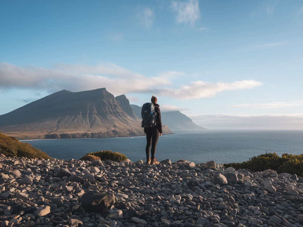
This is a wilder, cliff-top day with incredible views. Keep to high ground paths where shown on your map and watch tides if you plan any shoreline sections. Sangobeg Bothy (check Mountain Bothies Association notes before you go) is a simple shelter; arrive with stove fuel and food for a relaxed evening. If the bothy is occupied, have a campsite backup or return to Durness. - Day 3: Sangobeg to Cape Wrath turn (optional detour) then back across moor to Durness (approx. 15–18 km)
If you’re feeling adventurous, a Cape Wrath detour requires careful planning and tidal sense; alternatively take an inland route back, crossing moorland and small burns. Finish the day with a proper meal in Durness or a hot tea and cake at a local café.
Bothy etiquette and alternatives
Bothies are wonderful, but they work best when everyone follows simple rules. I always carry a stove (I use a small MSR PocketRocket) rather than relying on an open fire; that reduces damage to trees and vegetation. Pack in dry fuel, take every scrap of rubbish out, avoid lighting fires unless explicitly permitted, and strike a quiet, considerate tone for shared spaces.
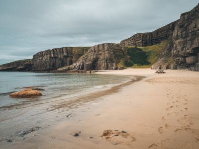
If a bothy is full or you prefer a softer night, there are a few B&Bs and self-catering cottages in Durness. Booking ahead during peak months (June–August) helps the local economy and keeps pressure off fragile sites.
Low-impact camping tips I follow
- Use an existing pitch where possible; if not, choose durable surfaces (rock, gravel, dry grass) and avoid fragile vegetation.
- Keep group sizes small—three to four people feels right for the remote coastline.
- Use a lightweight tent like a Vango or Rab model to reduce footprint and pack weight.
- Store food securely to avoid attracting wildlife and never feed animals.
- Dispose of human waste responsibly—use a trowel and bury at least 15–20 cm deep and 50 m from water, tracks and bothies, or pack out waste where required.
Gear and food choices that make low-impact travel easier
I keep my pack light so I can stick to paths and avoid creating new tracks. Essentials I recommend:
- Lightweight tent or bothy stove + fuel
- Quality waterproofs (I’ve had good seasons out of a Rab waterproof and a Berghaus shell)
- Map + compass and the OS Maps app (offline maps downloaded)
- Bare minimum of food: a mix of easy hot meals (dehydrated options or couscous), snacks, and local purchases from village shops
- Reusable water bottle and a filter (I use a Sawyer Mini) to avoid single-use plastics
- Small first-aid kit and emergency bivvy
Wildlife, seasons and responsible viewing
Durness is rich with seabirds, otters, seals and often happy hares or red deer on the moor. I slow down and use binoculars rather than approaching animals. From late April to July many coastal cliffs host nesting seabirds—keep your distance, avoid cliff-edge paths that are restricted and stick to alternative inland routes if signs are posted. Respect crofters’ land and livestock; gates left as you find them and avoid disturbing lambing ewes in spring.
Safety and emergency planning
Weather changes rapidly here. I check the Met Office and Mountain Weather Information Service (MWIS) before I go and carry layers so I can adapt. Tell someone your plan and expected finish time; leave a note at your accommodation or with a friend. Cell signal is patchy—consider a personal locator beacon (PLB) or an InReach device for solo trips. Finally, know the basics of river and burn crossings; they look simple but can be dangerous after rain.
How I balance wildness with supporting locals
I never carry every meal. Buying bread, cakes or fresh milk in Durness or popping into a café for a lunch stops reduces my pack weight and puts money into the community. I also share stories with crofters and rangers when I can—local insight often points to lesser-known routes and seasonal hazards that maps don’t show.
If you want a personalised route—shorter days, an overnight bothy recommendation or the best photo spots for golden hour—drop me a note via the contact page at Hillside Durness Co and I’ll sketch something to suit your pace. Safe walking and leave the place better than you found it.