I’ve walked the stretch between Sango Bay and Balnakeil more times than I can count, and every time I learn something new about how long it really takes when you factor in tides, photo stops, and the inevitable pause to watch seals. Below I share a practical, paced timing plan to complete the route in one day—whether you’re a brisk hill-walker or someone who wants a slower, photography-friendly day on the coast.
Overview: distance, terrain and what "one day" means
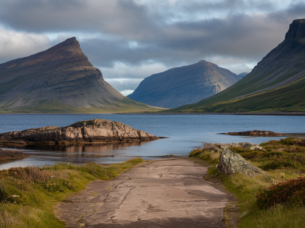
The direct coastal route from Sango Bay to Balnakeil is roughly 8–10 km depending on exact start and finish points and the side paths you take. Terrain is a mix of soft beach sand, pebbled foreshore, grassy cliff-top tracks and occasional rocky sections. There’s little steep climbing compared with inland Highland routes, but underfoot conditions and weather can slow you down.
When I say "complete in one day", I mean a comfortable day out of about 6–8 hours on the move (including stops). That allows time for photography, a relaxed lunch, wildlife watching and safe tide planning. If you want to rush the walk without lingering, you can do the route in 3–4 hours, but you’ll miss the best moments.
Suggested pace and timing breakdown
This is a time table I use and adapt depending on weather and who I’m walking with. I assume a moderate pace on mixed terrain: about 3.5–4 km/h on grassy/track sections, 2–3 km/h on soft sand, and extra time for photography or tide detours.
| Section | Distance (approx.) | Pace estimate | Time allocation |
|---|---|---|---|
| Sango Bay start to Sango Sands | 1.5 km | 3.5–4 km/h (track) | 20–30 minutes + photo stop |
| Sango Sands along the beach to Stoer | 2.5–3 km | 2–3 km/h (sand) | 60–90 minutes (including tide check) |
| Stoer headland & cliff-top path | 1.5 km | 3–4 km/h (track) | 25–35 minutes |
| Stoer to Balnakeil (coastal stretch with detours) | 3–4 km | 3–4 km/h (mixed) | 60–90 minutes |
| Lunch, wildlife watching, photos | — | — | 45–90 minutes |
Allow a total on-the-path time of roughly 3–5 hours and add another 1–3 hours for breaks, tide calculations and photo sessions depending on how often you stop.
When to start and tide considerations
Tide matters on this coast—some rock and beach stretches are much harder (or impossible) at high tide. I usually aim to start early, around 08:00–09:00, especially in summer when daylight is long. Starting early gives you softer light for photos and more flexibility with tides.
- Low tide window: If you want to walk on the foreshore rather than clifftops, consult a tide table and plan to cross the lower sections within a two-hour window either side of low tide.
- High tide alternative: At high tide you might need to use higher clifftop paths—this adds time but is safer in rough conditions.
- Check local advice: Chat to locals or rangers in Durness before setting off if tides are unusually high or stormy.
My recommended day plan (sample itinerary)
Here’s a realistic itinerary I use when I’m showing the route to friends and readers:
- 08:30 — Arrive at Sango Bay car park. Quick kit-check, fill water, check tide chart.
- 08:45 — Start walking. Gentle warm-up along Sango Sands; stop for first photos (20–30 mins).
- 09:20 — Continue along beach towards Stoer. Keep an eye on the tide and choose clifftop path if needed.
- 10:30 — Short coffee/snack break at a sheltered viewpoint near Stoer (15–20 mins).
- 11:00 — Cross the headland and follow coastal tracks towards Balnakeil, with time for wildlife watching.
- 12:30 — Picnic lunch at Balnakeil bay or a grassy clifftop—ample time to relax and photograph (45–60 mins).
- 13:45–15:00 — Option to explore Balnakeil dunes, head back via an inland route, or catch a lift/arrange transport.
This schedule gives a comfortable finish mid-afternoon with time to spare for slower walkers.
Pacing tips: how to manage effort and keep energy up
- Break the walk into chunks: mentally treat the route as 4–5 short sections rather than one long slog.
- Snack small and often: I pack energy bars, a sandwich, nuts and a thermos of tea. Eating every 60–90 minutes keeps your legs light.
- Adjust pace to underfoot conditions: sand slows you down a lot; factor in at least 50% extra time for long sandy stretches.
- Use poles if you have them: they help on soft sand and rocky descents and save energy on long days.
Transport and logistics
There’s no frequent public transport directly between Sango Bay and Balnakeil. I usually:
- Park at Sango Bay if I’m starting there and arrange a taxi from Balnakeil to return to my car. Local taxi services operate in Durness—book ahead on busy weekends.
- Coordinate a car shuffle with fellow walkers.
- For a linear walk without a car, check local bus times early; services are sparse and not always practical.
Gear I recommend
- Waterproof layers (I love my Gore-Tex jacket for these coasts) and a windproof midlayer.
- Sturdy waterproof boots or trail shoes with good grip.
- Lightweight trekking poles, especially for sand sections.
- Camera, spare batteries and a lightweight tripod if you want long-exposure sea shots.
- Map and compass or a fully charged phone with offline map—GPS can fail in gusty coastal weather.
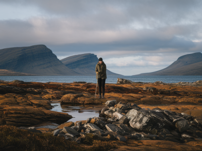
Wildlife, photography and moments to linger
This coastline is brilliant for seals, seabirds and occasionally dolphins. I always build in time to watch seals at the surfline—if you get lucky, they’ll pop their heads up just a few metres away. For photographers, the hour after sunrise and the hour before sunset give the best contrast on the cliffs and gentle golden light on the beaches.
When photographing cliffs and beaches, I favour a neutral density filter for silky waves and a longer lens (70–200mm) for wildlife. But don’t let photography slow you to a crawl—pick a few key spots and enjoy the rest of the walk without fussing over every shot.
Safety and responsible travel
- Tell someone your plan and estimated return time.
- Avoid cliff edges in high winds and keep dogs under control—sea birds nest on the cliffs in season.
- Carry a basic first aid kit and a waterproof bag for your phone and camera.
- Follow leave-no-trace: take all litter with you and respect crofting land—close gates and stay on paths where requested.
Walk the route once with a relaxed mindset and you’ll quickly understand how your personal pace compares to these estimates. For many visitors the joy of Sango Bay to Balnakeil is not how quickly you finish but how many little pauses you remember—seal spottings, a perfect tide pool, and that slice of sunlight on the cliffs. That’s why I always build extra time into my day plans.