I get asked all the time how to reach the remote trails around Durness without a 4x4. I live here and have learned the hard way that you don’t need a rugged vehicle to enjoy the wild coast—but you do need planning, flexibility and some local know‑how. Below I share everything I use when I’m guiding friends or writing route notes for Hillside Durness Co (https://www.hillside-durness.co.uk): public transport routes, sensible car hire choices, taxi and shuttle tips, packing and gear notes, and how to avoid the most common mistakes.
Getting to Durness by public transport: the basics
Durness is delightfully remote. That remoteness is part of the charm, but it affects timetables and connections. The main national rail and coach hubs you’ll use are Inverness (major rail/coach interchange), Thurso (Far North Line), and regional coach services that link to the northwestern coast. From these hubs you’ll need onward transport: local buses, community minibuses, taxis or pre-booked transfers.
My usual route recommendations:
- Fly or train to Inverness. It’s the easiest major hub with car hire desks, frequent trains and coaches to the north.
- From Inverness, take a coach (Stagecoach / Scottish Citylink services vary seasonally) or a train as far as Thurso or Lairg, then connect with local buses or taxis to Durness.
- If you’re travelling light and on a budget, plan for one or two transfers and check service days carefully—many rural buses run only a few times a week out of season.
Local buses and community transport
Once you’re north of Inverness the frequency drops. I always check local council timetables and community transport options before I set off. The Sutherland area runs a mix of scheduled buses and Community Transport (volunteer minibuses) that serve remote villages. These services are invaluable but often require advance booking.
- Timetable check: Look up Highland Council timetables and the specific community transport numbers for Sutherland. I also phone local info centres—people answer and give realistic advice on what will get you to a trailhead before dusk.
- Book early: Community shuttles can fill quickly in summer. If you need a drop-off at a trailhead, ask about flexible stops rather than expecting a bus to stop at an unmarked layby.
- Cashless payments: Many services now accept card or contactless, but carry some change for smaller operators.
Car hire without a 4x4: what to choose
Hiring a car is often the simplest way to reach trailheads around Durness, and you don’t need a 4x4 for most routes if you choose appropriately. I rent small SUVs or robust hatchbacks rather than low city cars—something that gives a bit more ground clearance and space for boots, packs and muddy kit.
- Vehicle type: I prefer a small SUV (e.g. Nissan Qashqai, Toyota RAV4 hybrid) or a raised hatchback (e.g. Volkswagen Golf with higher trim). These handle narrow single-track roads, farm gates and gravel laybys better than a tiny city car.
- Tyres and clearance: Check the tyres and take note of the ground clearance when you pick up the car. Many hire companies stock “country packs” with all-weather tyres—worth the extra in autumn/winter.
- Fuel policy: Choose a full-to-full policy to avoid extra charges—and top up at Inverness or larger towns, not in tiny village garages where prices can be higher.
- Insurance and excess: Make sure your insurance covers single-track road incidents. Consider renting excess reduction from the company or using a reputable third-party excess insurer.
Hiring tips and practicalities
Here are the small, practical things that make a difference on a Durness trip.
- Book locally if possible: Large agencies are in Inverness; local hire firms sometimes have better-suited vehicles and more flexible pickup/dropoff options. Email ahead and ask if they’ll drop a car in a nearby town.
- Inspect thoroughly: Walk the car with the attendant. Photograph any scratches or dents from multiple angles and keep the images—this has saved me from unfair damage claims.
- Essential extras: Bring a physical map (A3 OS map or printed route notes), a phone charger, a paper note of emergency numbers, and a basic first-aid kit. Download offline maps (Maps.me, OS Maps) in case mobile signal drops.
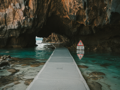
- Parking at trailheads: Many coastal trails have simple laybys or small car parks. Respect private driveways and always follow signage—parking unofficially can upset local crofters. If a trailhead has limited space, consider a short taxi drop and walk back.
Taxi and private transfers
Taxis are more expensive here than in towns but hugely valuable for early starts or one‑way hikes. I often combine public transport northbound and a local taxi for the return leg when timetables don’t fit my walk.
- Pre-book: Local taxi companies are small and may need notice—book the return at the same time as the outward leg.
- Shared transfers: In high season some hosts and B&Bs organise shared shuttle pickups for walkers—ask where you’re staying.
- Cash and card: Many drivers take card but check ahead; carry a small amount of cash for very rural pickups.
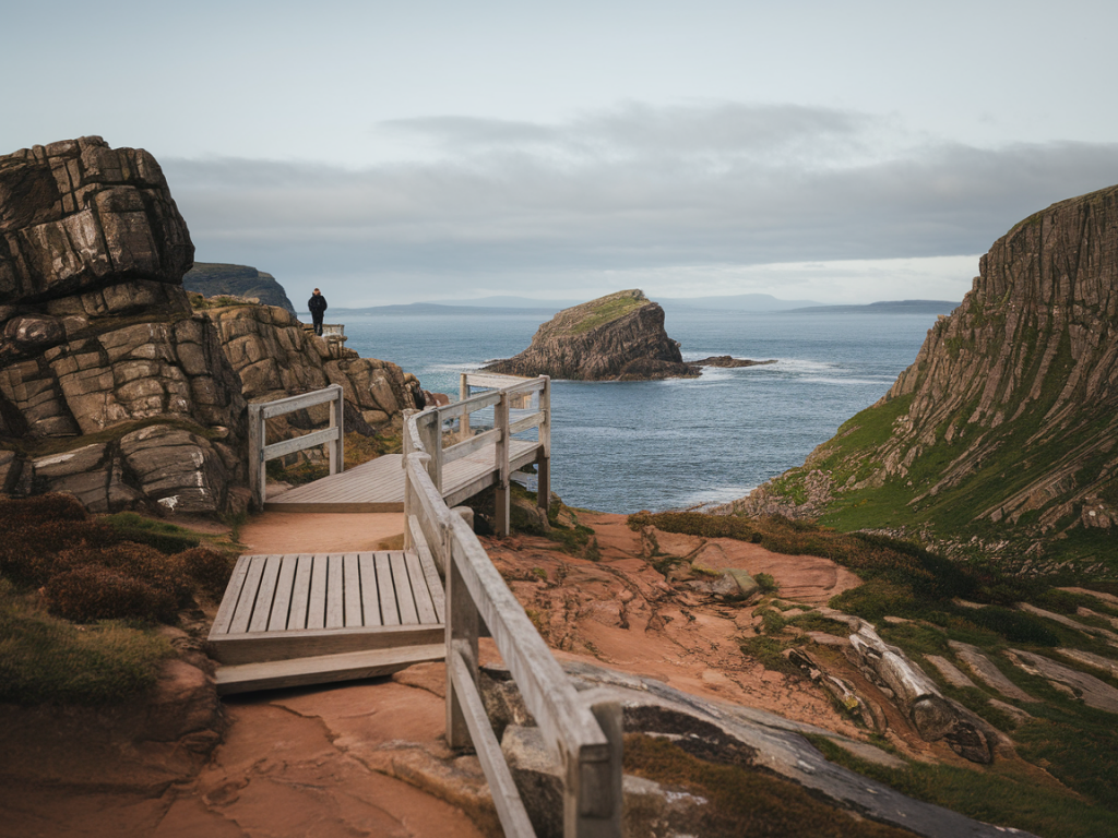
Practical packing & trail access tips
Exploring remote trails without a 4x4 means planning for self-sufficiency and terrain that can change quickly.
- Pack light but smart: Waterproofs, an insulating mid-layer, sturdy boots and gaiters are essentials. I always carry a headtorch even for daytime walks—weather delays happen.
- Food & water: Bring more than you think you’ll need. There are long stretches with no facilities and few bins—pack out what you bring in.
- Respect access rules: Stick to paths when crossing machair or croftland, and follow seasonal restrictions meant to protect ground‑nesting birds.
- Phone signal: Don’t rely on it. Share your route plan with someone, and if the route is remote, consider renting a personal locator beacon or carrying a satellite messenger.
Quick comparison table: transport options
| Option | When to use | Pros | Cons |
|---|---|---|---|
| Public coach/train + local bus | Budget travelers, non-drivers | Cheaper; low carbon; predictable routes | Slow; limited schedules; may need multiple transfers |
| Hire car (small SUV/raised hatch) | Couples/families wanting flexibility | Freedom to reach trailheads; space for kit | Cost; must drive narrow roads carefully |
| Taxi/private transfer | One-way hikes, early starts | Direct, reliable, no parking worries | Expensive; needs pre-booking |
| Community transport/shuttle | Local itineraries, seasonal services | Connects remote spots; community-run | Limited capacity; advance booking needed |
If you’re planning a specific walk and want route-by-route transport advice—where to get dropped, which laybys are legal, and which hire car suits that access road—drop me a message on the Hillside Durness Co contact page. I’ll happily share the up‑to‑date info I use when mapping the coast and arranging guided walks.