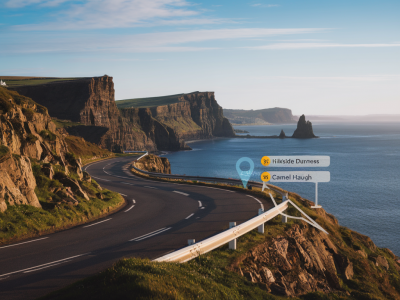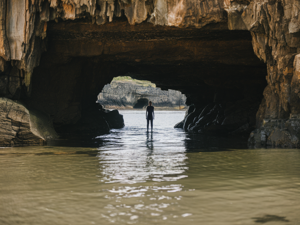
Walking to the sea caves at Sango Sands is one of those coastal experiences that stays with you: sculpted cliffs, echoing caverns and tide-carved arches framed by pale sand and Atlantic surf. But it’s also a place where the tide makes all the difference. I’ve guided this route, timed crossings, and waited on the shore more times than I can count—here’s a clear, practical guide to which tide window lets you reach the caves safely and how to plan the return so you don’t get stuck watching the tide come in.
Why the tide matters here
The cave network and arches at Sango Sands are intertidal features: accessible at low water when the sand and rock shelves are exposed, and partially or completely submerged at higher tides. The bay funnels water in quickly, and some route options require crossing rock platforms or narrow sections that are impassable on a rising tide. Getting the timing wrong doesn’t just ruin your day—it can leave you with a long, hazardous detour along wet rocks or, in worst cases, needing an improvised retreat up slippery cliffs.
Which tide window to aim for
I recommend planning your walk around the low tide and, ideally, starting on the falling tide. The safest window is the period that begins about 2 hours before predicted low water and extends to around 1.5–2 hours after low water. That gives you a buffer to explore the caves at low water and return while the water is still receding or only slowly rising.
Practical rule of thumb:
- Start no later than 1.5 hours before low tide if your route includes rock traverses or cave entrances near the waterline.
- Allow at least 2–3 hours on site if you plan to explore multiple caves, photograph, or scramble on the rock shelves.
- Avoid visiting within 2 hours of the high tide since the access can be cut off and waves are more powerful.
How to check tides and create a safe schedule
Don’t rely on memory—use a tide table or app and cross-check with local forecasts. My usual toolkit:
- UK Hydrographic Office tide tables or the Admiralty EasyTide website.
- Smartphone apps such as “Tide Times” or “Magic Seaweed” for tide and swell predictions.
- Local harbour noticeboards (if you’re nearby) and the Met Office for weather and wind warnings.
Example plan for a low tide at 14:00:
| Start walk | 11:30–12:00 (allowing 2–2.5 hours to reach beach depending on route) |
| Arrive at Sango Sands | 13:00–13:30 |
| Low water | 14:00 |
| Safe return window | 14:00–16:00 (return before tide becomes high and swell increases) |
Route choices and timing considerations
There are a couple of ways to reach the caves: the direct beach approach from Sango Sands car park and the coastal cliff path that drops down to the beach. The beach approach is faster but more tide-dependent; the cliff path gives a higher vantage but can be steeper and boggy in places.
- Beach route: Walk along the sand and rock platforms. This is the route fully exposed at low water and the one most affected by tide. Aim to be on the sand for at least 30–60 minutes either side of low tide.
- Cliff path approach: Gives you flexibility—if the tide comes in early you can retreat up the clifftop and walk along the path rather than risk wet rock. Add 20–40 minutes to your itinerary.
Signs the tide is turning against you
Even with planning, conditions can change. Watch for:
- Water creeping higher on rock benches or pooling in gullies you crossed earlier.
- Waves reaching further up the beach—especially with an onshore wind that pushes swell in.
- Fast-changing cloud and wind; a freshening south or south-west wind makes waves larger and more uncertain.
What to bring
Pack like you’re going to be out longer than planned. My essential kit:
- Waterproof jacket and layers—weather changes instantly on this coast.
- Sturdy waterproof boots or approach shoes with grippy soles (I often use La Sportiva or Salomon approach shoes).
- Spare socks, a dry bag for electronics and a headtorch in case you return late or detour through shaded gullies.
- Map and compass—or phone with offline maps (Gaia, Maps.me) and a portable battery pack.
- Emergency whistle and basic first aid kit.
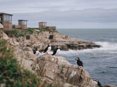
- Binoculars and a camera—Sango’s geology and birdlife are worth the extra weight.
What to do if the tide cuts you off
First—stay calm. In my experience the majority of tide-cut incidents are avoided with the right timing, but if you find the water rising:
- Don’t try to leap across submerged channels or run on wet rock; it’s easy to slip.
- Look for a higher line along the shore or climb to the cliff path—avoid tempting, unstable ledges.
- If you can’t return safely on foot, move to the highest safe point and call for help. In the Highlands, emergency numbers are 999 and ask for the Coastguard. VHF may be used by boat operators; don’t assume you can be seen from afar—make yourself visible.
Seasonal and weather notes
Summer brings longer daylight and milder conditions, but also more visitors and potentially stronger sea-breeze conditions later in the day. Winter tides are larger and swell can be unpredictable—I tend to plan more conservatively outside of late spring to early autumn.
Always check swell and wind forecasts. A calm sea with a close low tide is ideal. If swell is forecast at over 2–3 metres or wind is strong onshore, consider postponing—the caves aren’t worth the risk of crashing waves.
Local intelligence and last-minute checks
Before you go, I like to check in with local sources: the Durness visitor information, rangers if they’re on duty, or the café near the car park—people who’ve walked the beach that morning will tell you if the rock shelf is still exposed. And leave a clear plan with someone: which route you’ll take and your expected return time.
Walking to Sango Sands caves is rewarding when you plan around the tide. Treat the tide as part of the route, not an afterthought: choose the right window, pack for delays, watch the sea, and you’ll have the cliffs and caverns mostly to yourself—plus the satisfaction of a well-timed coastal adventure.